The Gibson photographs of Prussia Cove
Prussia Cove is famous for the stories of the Carter family and especially of John, the self-styled ‘King’ of Prussia. These stories have been put on a more reliable historical foundation in recent years, but the physical evidence for smuggling is harder to find.
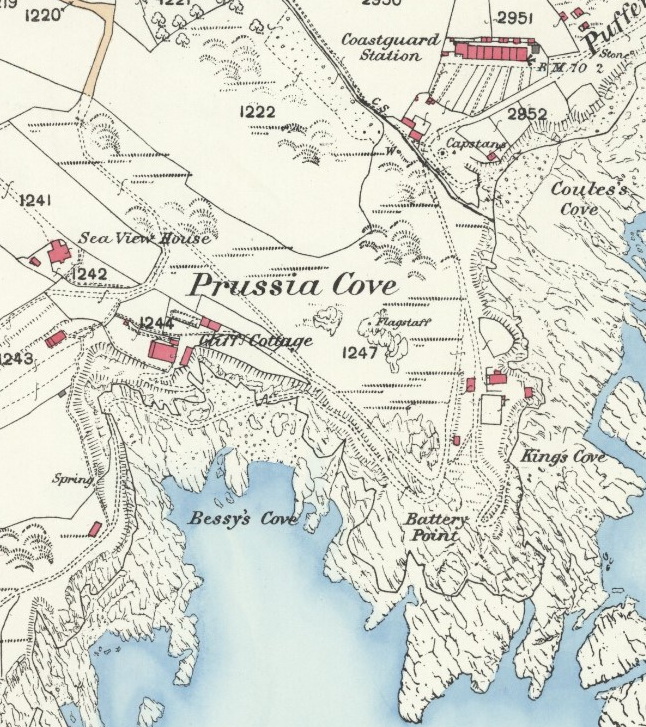
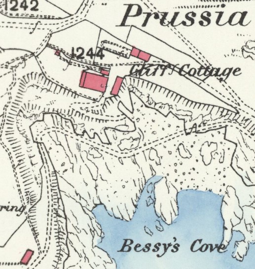
The battery which so concerned the Excise men after 1781 is marked on the 1877 Ordnance Survey map as ‘Battery Point’. The remains of what looks like a small platform can be seen on the headland as explained elsewhere.
Up until now, that has been pretty much the sum total of our evidence, but now, thanks to some photographs from the beginning of the C20, we can add in a smuggler’s cottage, the probable location of some smugglers’ tunnels and caves, and an image of what was possibly John Carter’s house.1
In the early years of the C20, Gibson & Sons, the well-known photographer from Penzance, took 22 pictures of the stretch of coast from Piskies Cove eastwards, via Bessy’s and King’s Cove to Coules’s Cove, an area known collectively as Prussia Cove. These images are now held in the archives of Penlee House and are an invaluable resources in helping us to understand the area.2
Conveniently, the Ordnance Survey map is nearly contemporary with Gibson’s pictures.
The Smuggler’s House
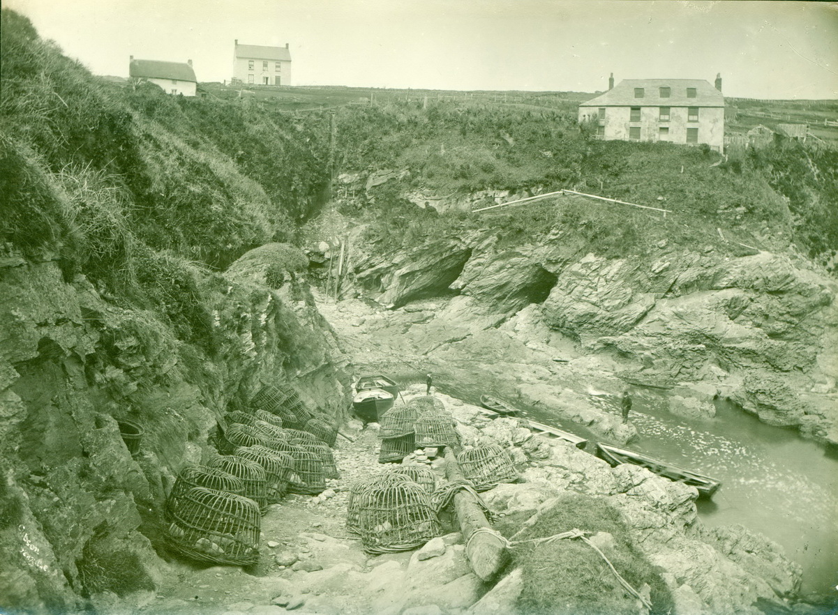
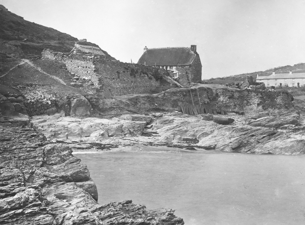
Perhaps the most exciting picture is one of part of Bessy’s Cove known as ‘Boat Cove’. Gibson helpfully wrote on the back of this ‘Smuggler’s house, Bessie’s Cove, Prussia Cove.
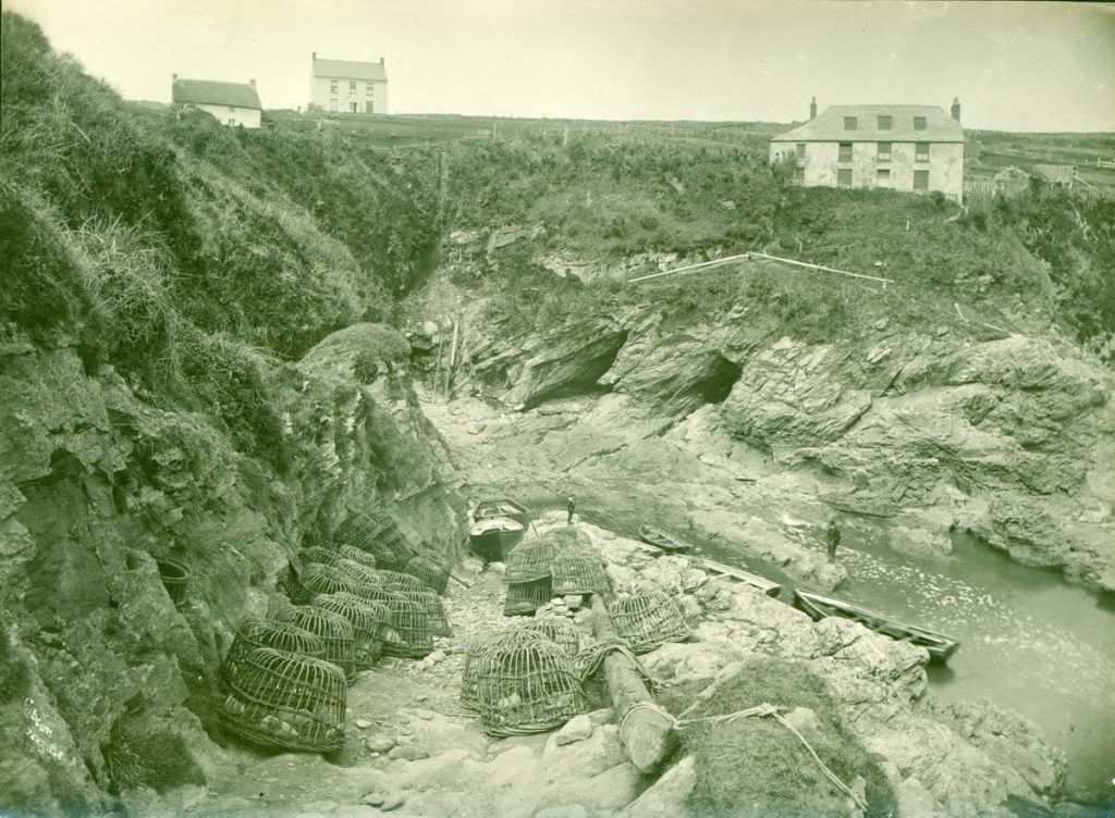
(Penlee House gibs0332 and gibs0347)
Three houses are visible: from left to right, they are Willy’s Cottage, Seaview House and Cliff Cottage (to use their modern names).3 Visible below Cliff Cottage are the mouths of two large caves.
In the foreground, leading up from ‘boat cove’ is one of the two slipways on the west of the cove which retains the remnants of a windlass, and capstan at their heads.
We only have Gibson’s word for it that this was once a smuggler’s house but a sequence of images of the interior suggests he was right.
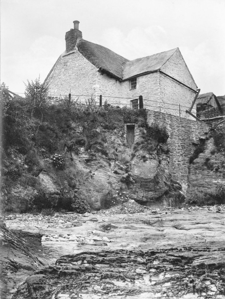
The Smuggler’s House Kitchen
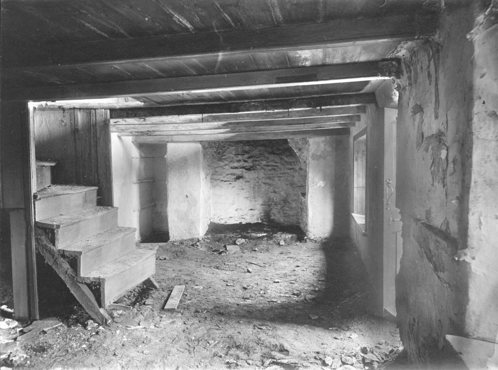
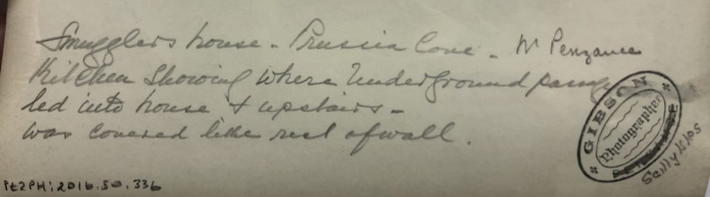
The back of another photograph bears a handwritten caption ‘Fireplace. Smuggler’s house, Prussia Cove, Nr Penzance. Kitchen showing where Underground passage led into house & upstairs. Was covered like rest of wall.’
The repetition of ‘Smuggler’s House’ identifies this pretty certainly as being the interior of Cliff Cottage as neither of the other two houses in the first photograph are large enough or so well-positioned for what follows.
The photographer leads us through a sequence of five images. The one above shows us a ground floor room with a staircase to the left and an open door to the right. As the light is coming from the right, the fireplace is probably at the eastern end of the cottage. Note the tall space next to the fireplace.
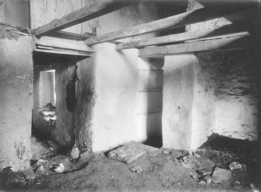
This tall space is shown in the second picture. There appear to be shelf brackets and a large paving slab has been removed and placed on the floor, revealing a black space. A doorway leads off to the left, perhaps into the back extension.
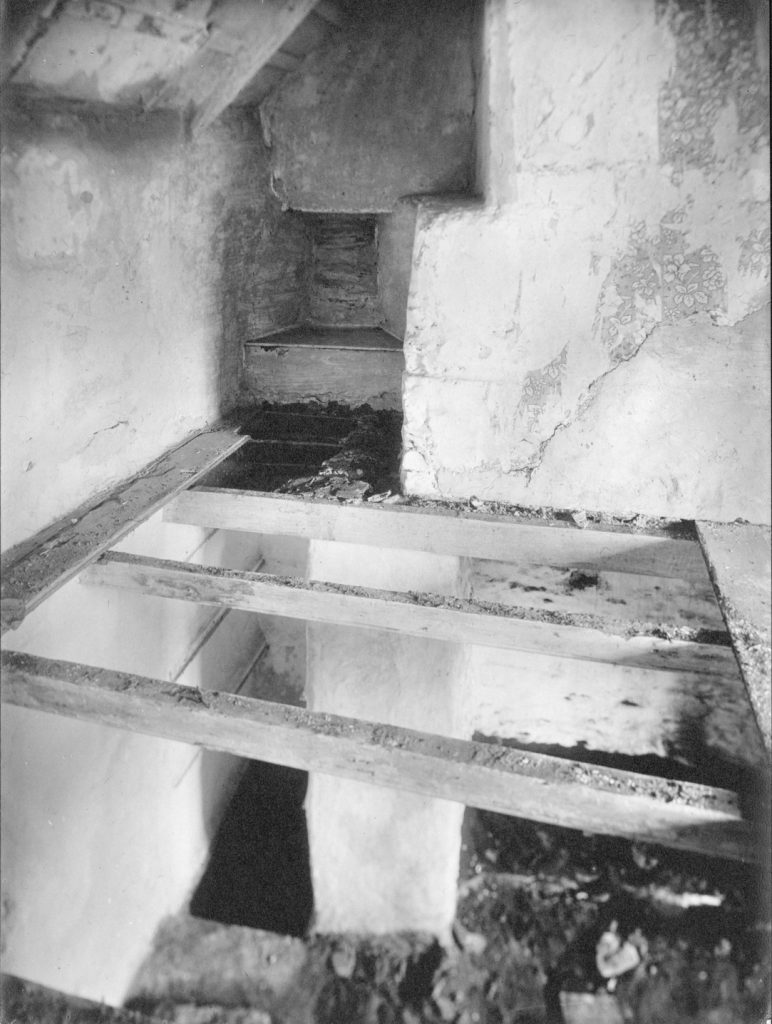
The third photograph shows the same view through the joists of what was the first floor.
What this sequence appears to show is that alongside the fireplace there was a set of shelves. By removing these, and the slab at the bottom, a space underneath the house was revealed: the passage referred to in the caption.
The last two photographs are rather harder to interpret.
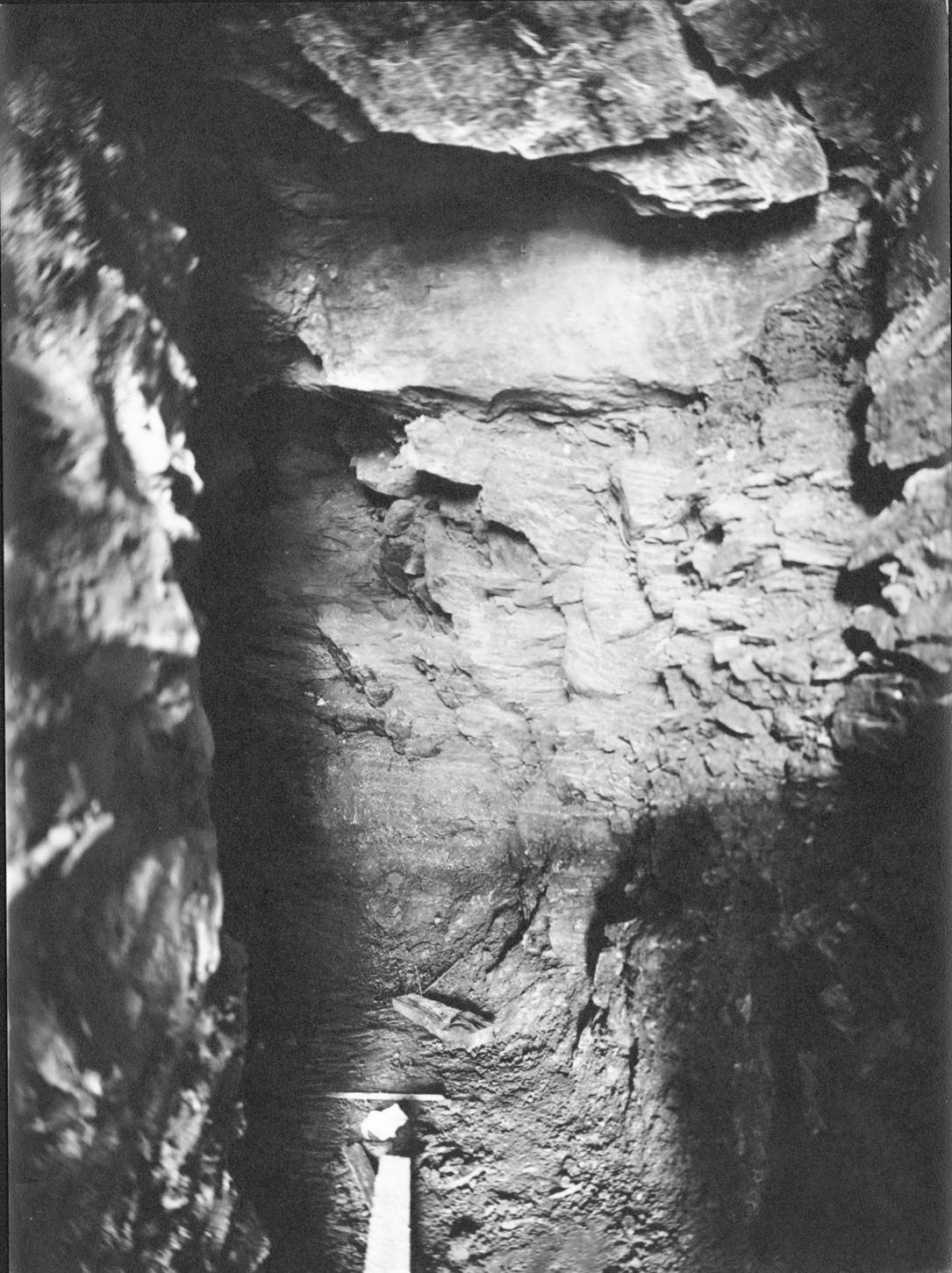
The first is catalogued as ‘Smuggler’s House, Prussia Cove’ and appears to show a space with what may be a piece of wood lying on the floor. The second is more enigmatic and is catalogued as ‘Smuggler’s Tunnel, Prussia Cove’. This appears to show a short sandy floor perhaps leading to a space which may be lit from above.
These two images do not relate to anything visible on the ground today. Is the first a view straight down from the fireplace, and the second perhaps a view of the cave seen from the beach?
The best we can conclude is that Gibson has identified a ‘Smuggler’s House’ with a kitchen having a hidden entrance to a passage which leads to a cave of some sort. But there is more.
The mystery of the cellars
The account of Charles Carter’s trial refers to the Excise men having …
… broke(n) open the door of one of his Cellars … they found a floor of boards some were loose they pulled up the boards the earth had the appearance of being recently moved they dug up the earth and they found under it a trap door which covered the mouth of a Cave in which there were 146 ankers of Brandy and Geneva they seized these articles.
They then went to a second Cellar where they observed that one of the stones of the floor was somewhat higher than the rest and there was likewise the appearance of fresh earth about the joints of that stone. Under the protection of a party of Soldiers they removed this stone which was got up with a good deal of difficulty and after clearing away the earth they found a trap door leading into another Cave – in this Cave they found 290 ankers which contained of Brandy 512 gallons of Rum 40 gallons Geneva 1760 gallons the total number of gallons were 2312.
This was an amazing haul and gives us some idea of the size of the caves. An anker was around 8 UK gallons (around 35 litres) and they report finding around 15,000 litres of spirits. A modern ‘small’ oil delivery tanker holding around 12,500 litres would not be large enough to contain this haul. Your local supermarket would charge you around £180,000 for this quantity of spirits.
Where were these cellars? The obvious place to start looking is in King’s Cove where John Carter lived but, as we will see, there is no sign of any caves round that side of the point. However, the 1888 OS map shows two structures to the east of Cliff Cottage. Could these be the two cellars (in the fishing sense – above ground and used for storing fishing goods, nets etc)? The court case says that the two cellars were separate as these are and there is later evidence of pilchard cellars having been in this area. One of the structures still retains evidence of having once contained a kiddly-wink (an illegal distillery).
If these were the cellars, then where were the caves?
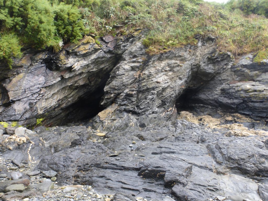
Cliff Cottage stands on its own small cliff. Beneath it there are signs of up to five separate caves or openings. The two on the western side are shown in Gibson’s picture of the Smuggler’s House. A modern picture of these shows that the caves are blocked by boulder falls. Clearance would not have presented a problem in a mining area in the late C18, of course.
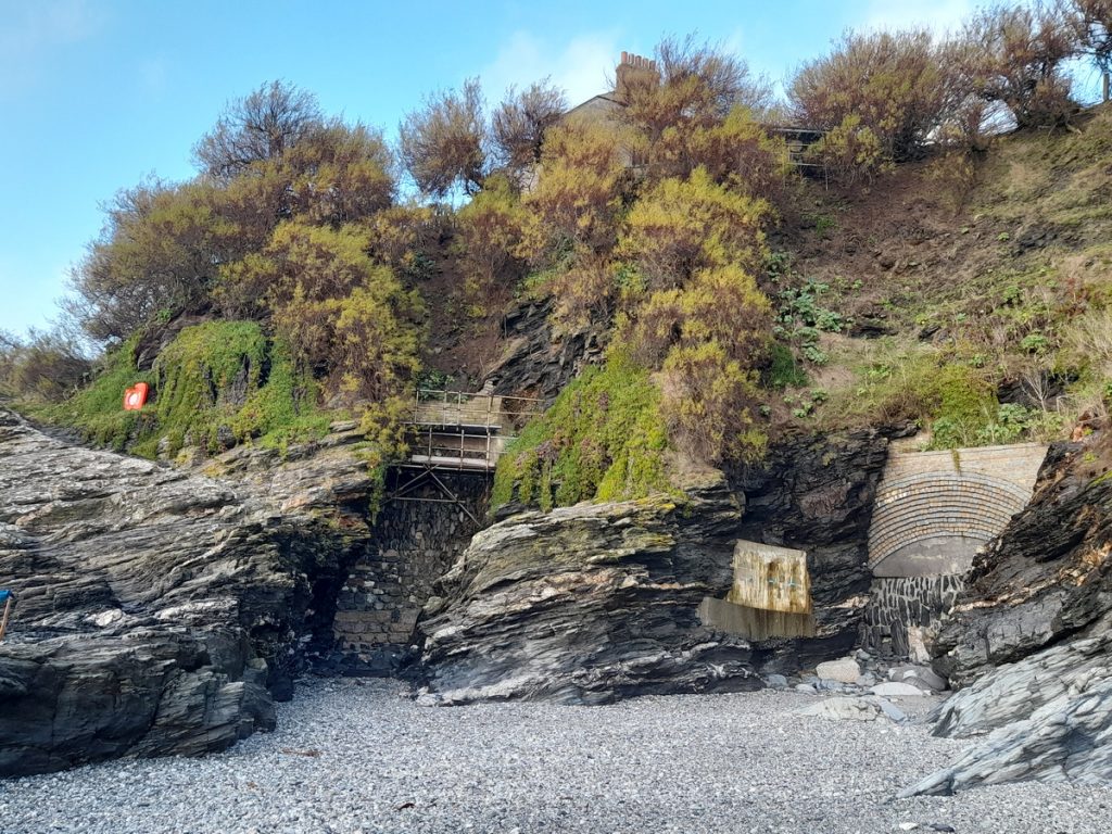
On the eastern side of Cliff Cottage, there are what look like the remains of two or three more openings, now blocked and reinforced to prevent erosion. Logic suggests that they extend back into the cliff perhaps under the Cottage and its outbuildings. (You can just see Cliff Cottage itself behind the trees at the top of the cliff.)
So, what can we conclude? The cliff under Cliff Cottage – the Smuggler’s House – has caves of varying sizes. All are now inaccessible and so we can only speculate whether they were connected to the house and its out-buildings. The best guess is that two of the easterly caves were connected to the two cellars shown on the OS map and that these were the cellars mentioned in the court case. We have no way of knowing whether the kitchen passage connected to one of these caves or to one of the two westerly caves.
Where was John Carter’s house and what happened to it?
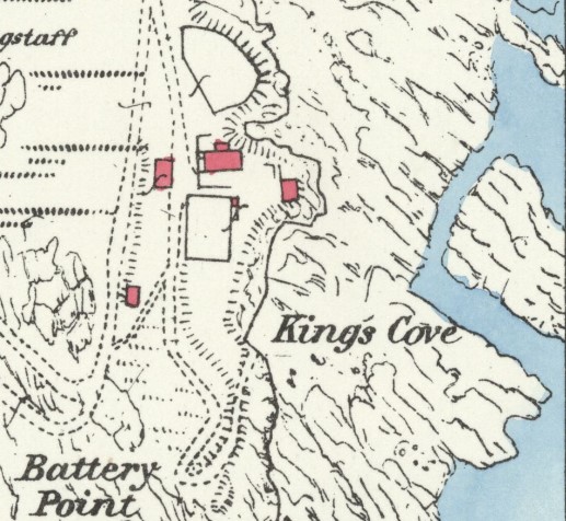
The simple answer is that we do not know for certain but all the evidence suggests that his house was underneath the modern Porth-en-Alls house, a familiar landmark for walkers along the coast path.
Accounts of John Carter talk of him living at Porth Lea, the original name for King’s Cove. John and his brother Charles both died in 1803 and there is very little reliable information on what happened next.
The 1888 OS map shows a T shaped house with two other structures and a large courtyard or lawn area.
At that time, the large T-shaped house which the 1901 census tell us was occupied by either a William or Joseph Allen, both fishermen.
(Penlee House gibs0334)
Gibson also took pictures of this house. The first shows the three buildings seen from King’s Cove.4 The shed on the left of the house is obvious, as is the house. To the right, just visible, but in a very dilapidated state, is the second ‘shed’, little more than a ruin.
In the foreground is the beach of King’s Cove which had been adapted to provide a safe harbour for boats. The large, rectangular structure in front of the house is today a walled garden, a veritable sun-trap, protected from the cold easterlies and the prevailing south-westerlies. Visible on the outer wall of the rectangular structure is a row of notches for pilchard presses.
In the distance, is the row of Coastguard cottages, above Coules’s Cove.
Gibson’s second picture shows the house from the north east. The large shed is just visible in the background. The most curious feature is what seems to be a door in the cliff which appears to be going nowhere. Could there have been a series of stone steps that have been washed away – the friability of the cliff is obvious – was there once a wooden ladder to the beach, or was it simply a chute for waste?
There is no evidence that this was once John Carter’s house but it is hard not to draw that conclusion. It is certainly on a very suitable spot at the head of the cove and there is no evidence of the remains of any other building in the area. It may look rather large for a mining family in late C18 Cornwall but Gibson’s photographs were taken from low down and may exaggerate the height. If it was not John Carter’s house then this house was almost certainly built on the site of it.
Shortly after Gibson took his pictures, work started on a modern house. This was protected from erosion by the construction of strong retaining walls. Somewhere behind these is the only evidence of that curious door in the cliff, and any other evidence of John Carter.
But …
The OS map and the pictures show two sheds associated with this house. Could the two cellars mentioned in the court case be here rather than at Cliff Cottage?
The difficulty is that neither of the sheds in the pictures looks large enough to fit the description in the court case and no one has yet found evidence of any caves under this part of the cliff. It is possible that there were once caves here, which have been long since washed away but it is strange that there is no evidence at all and that this section of cliff has no other caves. Any cave would have had to be very large and its erosion would surely have destroyed the large rectangular structure as well.
Also, if these were the two cellars mentioned in the court case then why was Charles in the dock at the Old Bailey and not his brother John, the owner of the house and cellars in King’s Cove? Everything points to Charles having owned the cellars at Cliff Cottage and possibly the Cottage itself. It was his cellars beside Cliff Cottage that were broken open by the Excise men, not those of his brother at King’s Cove.
The Other Gibson photographs of Prussia Cove
We cannot leave the story there for Gibson took other photographs of the area. These do not tell us anything new about smuggling or the Carters but do record the cove at the beginning of the C20 when tourists were starting to appear, brought to the area by the railway.
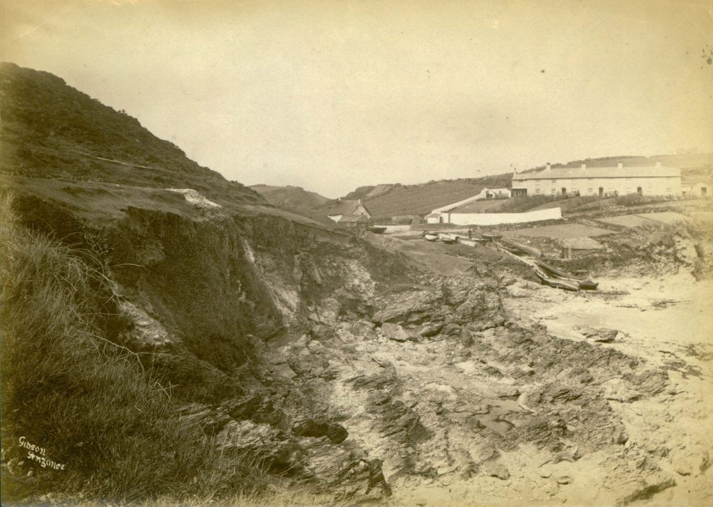
The first picture shows Coules’s Cove, just next to ‘John Carter’s’ former house. This shows that the cove was being actively used by small inshore fishing boats into the C20. The map shows a capstan installed at the head of the cove and there was much easier access for boats than there is today. The former slipway has long since eroded away.
The seven Coastguard cottages, built in 1826, with their walled garden are obvious. Just to the left of them is the roof of a structure which is shown on the OS map and may have been a fish cellar and/or dwelling and/or have been used to sell teas to passing tourists. This structure is now derelict and has been re-claimed by nature with only a few vestigial walls remaining.5
As with any photograph of the time, one is struck by the lack of mature trees. This may have had much to do with the need for wood for fires and the proximity of mine workings on ‘Puffer Cliff’ out of sight to the right of this photograph.
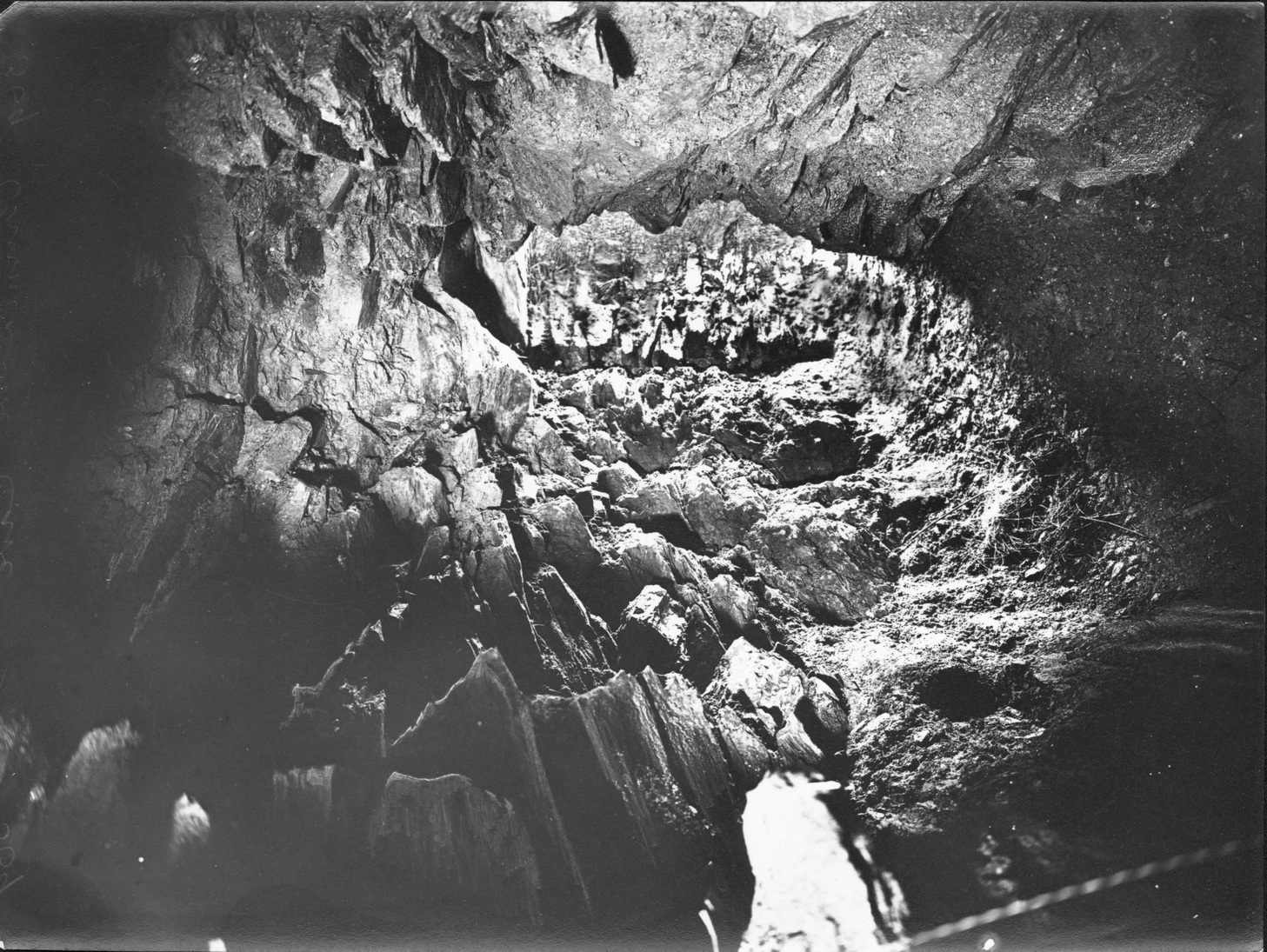
Gibson also took 9 photographs of caves, all of which are recognisable today and most of which are in Piskies Cove. One will suffice for this account.
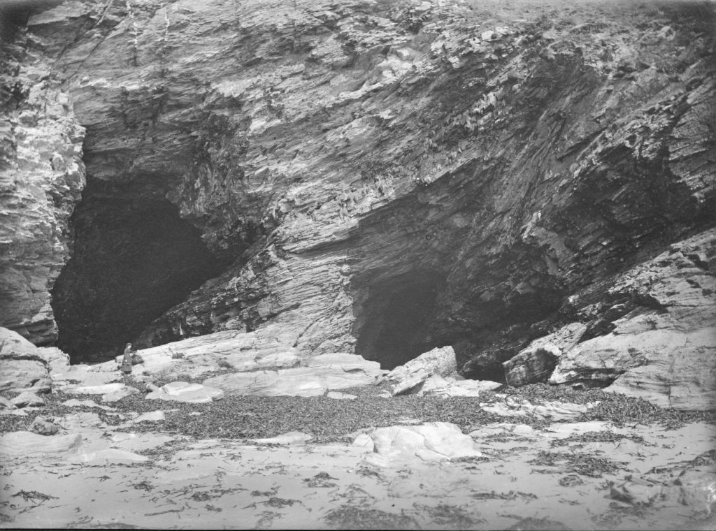
Enjoy spotting the small figure of an elegantly-dressed Edwardian lady in the mouth of the left-hand cave. This gives you some idea of the size of the two largest caves in Piskies Cove. Both flood at high tide and would not have been suitable for anything other than very short-term storage despite the stories told by passing tripper boats.
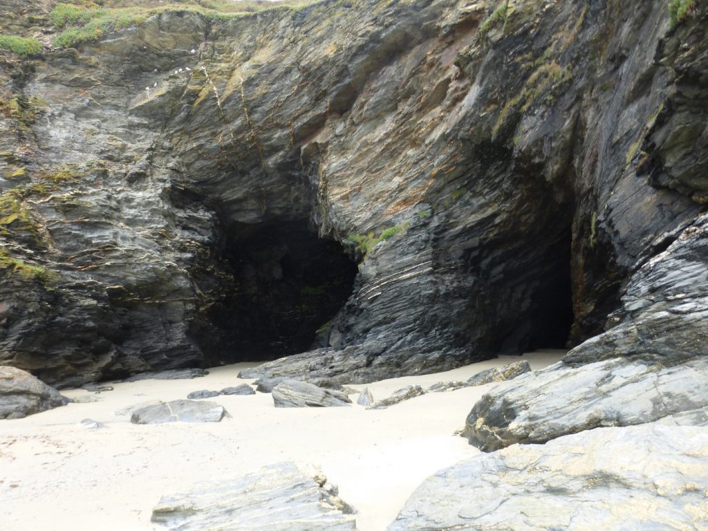
A modern image shows how the contour of the beach changes during the year, as the sand is scoured out by storms or returned freshly washed for the summer season.
- Many of the locations mentioned in this article are on private land but the SW Coast Path passes through the cove, and they can be seen from that path
- The author gratefully acknowledges the assistance of both the owners of the estate at Prussia Cove and the team at Penlee House in the preparation of this article
- Cliff will be familiar as the house which featured in the film Ladies in Lavender
- Not accessible to the public
- This structure, which is just across a small stream which issues into Coules Cove, could be the cellars referred to in the 1792 report. These cellars, known to be owned by Charles Carter, should not be confused with those referred to in the court case and main article as the building is too small and, given its position alongside a stream, could not possibly have had two underground cellars