As a lad growing up in Newlyn, tales of the exploits of the Carters of Prussia’s Cove,1 fascinated me. So much so that ever since I have been intrigued to find out what lay behind these tales, and was there any truth behind some of the more audacious acts attributed to them. In particular the yarns relating to a cliff-side battery of cannon blazing away at any vessels that dared to come within range unbidden.
In my quest for information about the Carters, Cornish2 and Pollard, were key primers, along with Harry Carter’s autobiography, which I found frustratingly skimpy as to smuggling, and dreary in the extreme in the lengthy passages relating to repentance and ‘seeing the light.’ But then, after reading a few of Cornish’s supporting notes in the Cornwall Record Office with abstracts from Penzance Custom House officers’ correspondence, I found the way.3 I discovered the key prime source – in so far as smuggling in Mount’s Bay was concerned – the revelatory Custom House letter-books for the Port of Penzance, then held in the Public Records Office – more recently re-branded as the National Archives.4 These letter-books are the office-copies of the ‘Out-Letters,’ from the Penzance officers to the Board of Customs in London [1738-1878], with elements of related local correspondence, and the ‘In-Letters,’ from the Board to the Officers at Penzance [1722-1914]. The whole comprising 150 odd heavy manuscript volumes of the letters to and from the Board each year. Both sets were numbered throughout the year, and counter-checked at the end of the year to ensure due receipt and action.
In time the extensive content of these letters led to other ‘gems’ in the National Archives: Treasury papers, Admiralty archives, Privy Council, Home Office, and the key Exchequer trial reports, all proving that truth can be more engrossing than fiction.
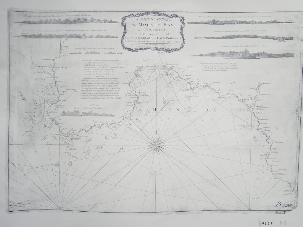
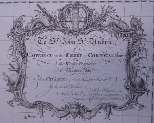
Contemporary with this period are the first reliable charts delineating the shores of Mounts Bay. The earliest of these, surveyed by John Thomas, John Nancarrow and Dionysius Williams, and engraved by T. Kitchin, was ‘Published according to Act of Parliament,’ on January 30th 1751. It was dedicated – ‘To S.r John S.t Aubyn …. The Worthy Proprietor of Mount’s Bay.’ – a loose claim that was disputed by Lord Arundel, the Earl of Falmouth and others with coastal fiefdoms.
This chart was the basis of at least two reprints, with additions, and John Thomas is the key-link between the different versions. The second version, attributed to John Thomas & William Denys, was published by Robert Sayer, Map & Chart-seller of 53, Fleet Street, on June 10th 1786. While the third version by the same author-surveyors was published with minor additions to the notes by Laurie & Whittle, of the same Fleet-Street address in 1794.
Tony Pawlyn